Murray River System - Barrages
Background

The River Murray System represents the following:
- the main course of the River Murray and all its effluents and anabranches
- tributaries entering the River Murray upstream of Albury
- the Darling River downstream of the Menindee Lake storage
- Commission works - Dartmouth Dam, Hume Dam, Yarrawonga Weir. Lake Victoria storage, weirs and locks along the River Murray and lower Murrumbidgee, and the barrages near the mouth of the River Murray
- the Menindee Lakes storage, which the NSW Government has leased to the Commission in perpetuity
Since the completion of Hume Dam in 1936, a continuous flow has been maintained throughout the length of the Murray. Without storages and regulation, the Murray would almost certainly have ceased to run during the droughts of 1938-39, 1944-45, 1967-68, 1982-83 and 1997-98.
In its natural state, the River Murray was quite different from the regulated river we have today. During severe droughts it was sometimes reduced to a chain of saline waterholes. In South Australia, sea water infiltrated upstream for a considerable distance from the mouth.
During a normal year, Adelaide draws more than 40% of its water from the Murray. During droughts this dependence increases to more than 90%. Without our present system of river regulation, the population of Adelaide and many other cities and towns in the Murray Valley would be considerably smaller than they are today.
To regulate the river system, River Murray Water operates four major storages, sixteen weirs, five barrages and numerous other smaller structures.
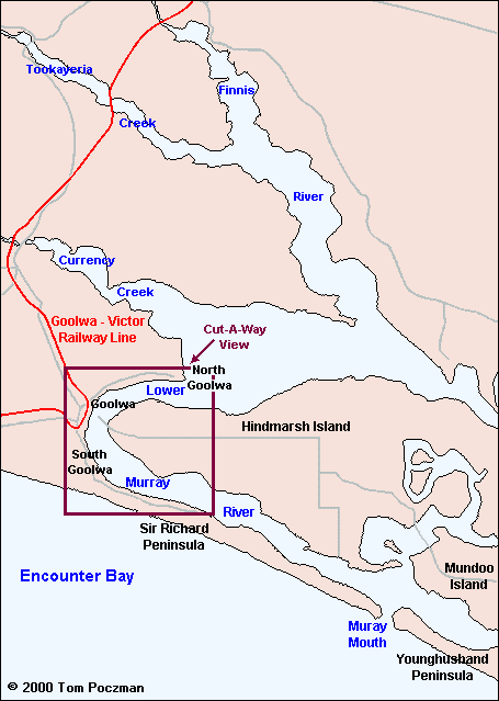
The Barrages are located in the channels linking the most downstream lake on the River Murray, Lake Alexandrina. Flow passes through the Barrages into the Coorong and out to sea through the Murray Mouth.
During low flows prior to the commissioning of the barrages, tidal effects and the intrusion of seawater were felt up to 250km upstream from the mouth of the Murray River.
From the earliest days of settlement along the lower reaches of the river there were strong representations from landowners for the construction of barrages, primarily to keep the water fresh in the lower reaches of the River Murray, as well as Lake Albert and Lake Alexandrina.
In 1931, the Commission decided after an extensive investigation that five barrages be constructed. Work on the barrages commenced in 1935 and was completed in 1940. South Australia's Engineering and Water Supply Department undertook the works, with costs shared equally by the Governments of Victoria, New South Wales, South Australia and the Commonwealth.
Purpose
The purposes of the Barrages are to
- reduce salinity levels in the lower reaches of the River Murray and associated lakes
- stabilise the river level, and normally maintain it above the level of reclaimed river flats between Wellington and Mannum, so as to provide irrigation by gravitation rather than pumping
- during low flows, to concentrate releases to the ocean to a small area, and so scour a channel for navigation
- maintain pool water that can be pumped to Adelaide and the southeastern corner of South Australia
Design Features
There are 5 barrages: Goolwa Barrage, Mundoo Barrage, Boundary Creek Barrage, Ewe Island and Tauwitchere Barrages. The water level upstream of the barrages is normally about .75 m higher than mean sea level. The barrages cause an increase in water level of approximately 50 cm as far upstream as Lock 1 at Blanchetown (274 km upstream).
The water level upstream of the barrages is set by the height of stop logs.
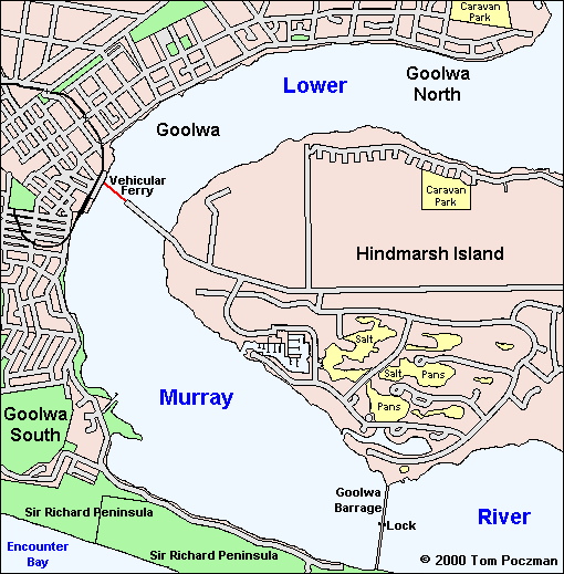
Goolwa Barrage is the deepest of the barrages. It is constructed on fine sand and silt, and is founded on timber piles and sheet piling up to 14 metres. The barrage contains a lock chamber 30.5m by 6.1m. The Goolwa Barrage is located 8km upstream of the Murray Mouth.


Ewe Island and Tauwitchere Barrages are built on a calcareous reef, across wide and shallow channels. There are earth embankments at both ends. At Tauwitchere, a lock of 13.7m by 3.8m has been provided for the use of fishing boats.
The Mundoo Barrage and Boundary Creek Barrage are the shortest of the barrages. They are founded on a limestone reef. No provision was made in these barrages to allow the passage of shipping.
Associated with the barrages is the reclamation of 486 hectares made to the Sir Richard Peninsula, to the west of the barrages. The purpose of this reclamation was to minimise sand drift entering the river between the barrages and the river mouth, and to maintain the protecting peninsula between the Goolwa Barrage and the sea.
Operating Procedures
Operation of the barrages to control lake levels typically involves frequent operation of stoplogs, particularly at the Goolwa Barrage. During periods of low river flow all the logs must be in place to completely stop the flow and maintain high lake levels. During floods, the stoplogs may all be removed. For intermediate conditions, constant regulation is required to prevent the entry of salt water and to keep the water level upstream at the required level.
The Catchment Area
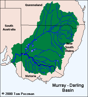
The River Murray is 2,530 km long. Only 8 km of this is downstream of the Goolwa Barrage. All of the major tributaries of the River Murray join it further upstream than the barrages.
South Australia is the driest state in Australia. Evaporation rates exceed precipitation in every month, even in the wettest areas of South Australia. For example, near the mouth of the Murray River, mean annual rainfall is about 450mm, whereas the mean annual evaporation is about 1600mm.
 Fishing Tip : Fishing Tip : |
|
| Why not contact fishSA.com about your Fishing Tip |
|
|